Frequently Asked Questions

What are Weather Satellites ?

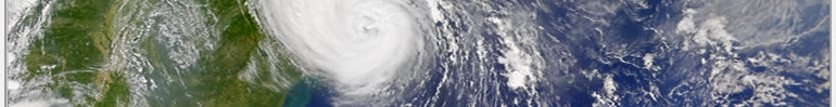
Weather satellites were first launched in 1960 by America to look at weather in real time. The National Geographic Magazine in August 1960 reported on the first image of the earth taken from space. Since then there has been steady progress, and more satellites have been launched on a regular basis. Remarkably, since the early 60's the format has not changed and the rest of the world has adopted the same standards.

Polar Orbiting

The first satellite was a polar orbiting type. Usually known as NOAA (National Oceanographic and Atmospheric Administration), these satellites orbit at about 850km above the earth. This means that they have a circular orbit that takes them almost directly over the North pole and South pole, and as the Earth rotates a different strip is imaged. The width of the image is 3000km and as the satellite travels above the earth's surface it scans a line twice a second. It scans continuously and therefore never sends a complete image, rather a continuous, never ending strip. The satellites use VHF radio to transmit their information directly into your home or office. Using frequencies just above 137MHz means that the satellite is receivable when it comes above your horizon, which can be as far away as 3,000km. In England for example this is from the middle of Africa to way over Iceland. The whole pass from horizon to horizon will take about 15 minutes and the area where you are situated will probably take the middle 5 minutes. Each satellite overlaps each pass and you can expect 2 good passes from each satellite twice a day, so 4 passes per satellite per day. There are two series of satellites, the afternoon NOAAs like NOAA 14 that pass over at about 2 o'clock after midnight and after midday. The morning NOAAs such as NOAA 12 and 15 pass over at about 7:30 in the morning and early evening. So with 3 operational satellites there are 12 good images a day. The Soviet Union also have a series of satellites and these can be received on any of our multi-channel receivers (not 2 channel). Soviet activity is usually fairly constant but can be unreliable and difficult to predict.

The NOAA satellites have two separate transmissions, APT (automatic picture transmission) is on 137MHz and is very easy to receive. APT is so strong that a fixed antenna will receive nearly all of the pass and certainly much more than you would ever want. So APT is easy and you do not need to move or track the small antenna at all. The other transmission is HRPT (high resolution picture transmission) on 1707MHz and is not so easy to receive. HRPT requires a small dish and you need to track it across the sky following the satellite.

Geostationary

In the late 70's it became obvious that a satellite transmitting 24 hours a day would be desirable. A satellite 40,000km away will orbit the earth once every 24 hours, exactly the same rate as the earth rotates, so from a fixed point on the earth the satellite appears stationary. A geostationary satellite is much further away from the earth than a polar orbiting type and often the resolution is not as good. However because geostationary satellites appear fixed, they can send images of exactly the same area as frequently as every 30 minutes in some cases. These frequent images can be processed by software to loop or animate, that is so that you see moving clouds from, say, the last 8 hours. This gives valuable information on the type, direction, and magnitude of the cloud and hence leads to very easy forecasting. There are several geostationary satellites such as Meteosat 7 over Europe, GOES 8 over Eastern America, GOES 10 over Western America, GMS over Australia/Japan and INSAT/Meteosat 5 over Russia/India.

Meteosat and GOES re-transmit images from other geostationary satellites so you can see the weather from Australia in London or Chicago for example.

Polar and Geostationary, can you explain further ?

Yes, if you look at the image below you can see 2 satellites. This is a snapshot in time. GOES 10 (Geostationary) has a big circle round it, and this is the area that it covers, like the whole of north and south America. Meteosat covers the whole of Europe and Africa and GMS the whole of Australia, Japan etc. To put these extra satellites on the map would confuse the issue and so we have tried to make it simple ! NOAA 15 (Polar Orbiting) is over New Guinea and is receivable in the smaller circle as shown. Remember that this is a snap shot in time and over the next 100 minutes it would travel right around the world. The circles of coverage that are shown do not appear as true circles; this is because of the map projection. If they were displayed onto a true 3D spherical globe, then they would be circular. And remember, there are a lot of satellites out there, more like a dozen instead of the 2 shown for simplicity.

What will weather satellites do for me ?

A lot ! Everyone needs to know what the weather is doing. Receiving live weather satellites gives you a unique real time view of the earth. If you plan to cut your grass, or sail round the world, you need to know what is happening. The level of detail can be quite dramatic, moving fronts can tell you not to go to sea, or a long clear period can change your plans easily. Astronomers can check for cloud cover in other continents before calling a friend to confirm a new sighting for example. Cloud temperature can be measured giving an indication of height, and sea surface temperature can be monitored for fishing or pollution control.

There are at least two types of image you can receive. Visible light is one, and this shows what you may expect to see if you looked out of the satellite. Visible sensors are good for low cloud and land detail but do not work in the night time though ! Infrared detects heat and as high cloud is very cold it appears white; space is even colder and appears even whiter. You can see cities as darker spots on the land as they generate more heat than the surrounding land. In fact the overall resolution in general is less than the visible sensor, but because it is a heat sensor it does not matter if it is day or night.

Satellite technology is fun too. The interaction of satellite, receiver and computer is one which is challenging and can stretch the mind. Teachers will value the ability to monitor the weather almost anywhere in the world from their classroom.

Remind me of the history; and, what about the future ?

Weather satellites started in 1960 and to this day the standard is exactly the same. As with everything electronic, nothing stays still, so some time the standards may change. However we have been assured that current systems will work well for at least the next 10 years ! Even then, in this far distant future, antennas and other parts will still be useable. Just like over the last 10 years we have progressed from using 8088 PCs to Quad Cores, in the next 10 years we will all slowly upgrade our weather satellite systems, and who knows where computers will be in 10 years time?

The different systems

APT Polar

APT satellites give about 12 good images a day, wherever you are in the world. The resolution is 4km per pixel and there are visible and infrared sensors. This is a simple system where the satellite is in low earth orbit and very easily received at 137MHz. The two frequencies in main use are 136.50 for NOAA 12 and 15 and 137.62MHz for NOAA 14. A simple crossed dipole antenna can be used, or for marine use a stainless steel Quadrifilar helix antenna. These simple omni-directional antennas do not need moving or tracking to receive the satellite. The satellite is so strong that when is about 20 degrees above the horizon perfect results will be obtained. As this is the lowest cost entry into weather satellites, a lot of people have asked if they could use their "scanner" that they use for monitoring other transmissions. There are two problems with using receivers not specifically designed for weather satellites. The first and most important is bandwidth, an APT signal needs about 40kHz of bandwidth, between 30 and 50 is OK. Most scanners have 15kHz which is far too narrow and 180kHz or more which is far too wide. Only a few scanners have the correct bandwidth and these are currently the AOR5000 and Icom IC-PCR1000. The second problem with all scanners, including the ones mentioned, is that a weather satellite system needs a very good performance receiver, one that provides high sensitivity, good signal to noise and high immunity to other adjacent transmissions. So, you may get your scanner to work, but it will not provide the results you see in our colour brochures. Our PROscan receiver has been specially designed to provide optimum performance.

MSG Geostationary

Meteosat Second Generation (MSG) has totally revolutionised weather satellite technology in Europe. Using simple reception systems, achieving 1km resolution and new images every 15 minutes gives the user unparalleled imagery. Animation has never been so detailed or so smooth before. It’s like the difference between WEFAX and PDUS but all over again, totally surpassing PDUS is a dream come true using the HRIT data stream. And now that the last WEFAX image has been transmitted, you must consider buying our MSG system!

HRPT

HRPT satellites give 1.1km resolution in 5 spectral bands. Two are visible, and 3 infrared. There are about 12 good images a day and this system will provide the very highest resolution possible from weather satellites. Because there are 5 sensors they can be mixed together to provide stunning colour images showing an incredible amount of detail. Remember that APT gives a pixel size of 4km and therefore an area of 16 square km per pixel. HRPT gives a pixel size of 1.1km and therefore an area of 1.21 square km per pixel, an amazing increase of 13 times resolution. But there is more, remember that there are 5 bands and that this is also a digital system that gives 10 bit data, 1024 grey or colour levels per band, giving a total of 50 bit data. The system is, though, both complex and expensive and is very definitely not for the beginner. A 90cm (3 foot) dish has to be tracked across the sky as the satellite orbits. This is all taken care of automatically and works really well in practice. There are only a few HRPT system manufacturers in the world, no commercially available receiver is capable of receiving HRPT and so, unless you are good at receiver design and home construction, you need to purchase a complete system from us.

WEFAX Geostationary (no longer transmitted)

WEFAX satellites give anything up to 400 images a day and can provide relayed images of the other side of the world. The resolution varies between 2.5 and 10km. There are 3 sensors, visible, infrared and upper atmosphere water vapour. The main frequency is 1691MHz and we provide a special receiver for this purpose. This signal from a 90cm (3 foot) dish and is amplified by a low noise preamplifier mounted directly on the dish, the 1691MHz signal is run down special high quality cable into our WEFAX receiver. The input to the receiver is 1691MHz and the output is an audio signal that you can hear. There are people who convert the 1691MHz signal down to 137MHz to use their existing APT receiver, the philosophy is fraught with problems and customers who have tried this and then upgraded to our WEFAX receiver have reported a huge increase in image quality and resolution. Our WEFAX receiver has been designed to provide optimum performance.

PDUS  (no longer transmitted)

PDUS is available from Meteosat and gives images of Europe in 2.5km resolution every 30 minutes. A 1.8m (6 foot) dish is required and it is fixed in one direction. The rest of the world is transmitted frequently in varying resolutions. The 2.5km resolution gives considerable detail to clouds and the image is not cut up at all like WEFAX. You will never find that you are on a join, like Greece is! We find the main use of PDUS is to provide a continuous animating sequence of all of the Atlantic Ocean right through to the Middle East, real time, dynamic pan and zoom together with good colour provides a huge increase in forecasting accuracy. The data is a digital stream on 1694.5 MHz and there are less than a handful of manufacturers, so you need to buy a complete system from us.

all contents © timestep electronics ltd 2009 | designed by james northam | domain names for sale